4

I want to make a path out of points and calculate the distances of each single line. I have a point layer with waypoints of a research vessel. The way points have in the attribute table a date and a time and are labeled either as on effort or as off effort. Now I want to make a line layer with a path from point to point according to the recorded time. This line layer should have the information about the associated waypoints in the attribute table. I that line layer I want to calculate the distances from one waypoint to the next in the attribute table.

I have tried the extensions "points to path" and "points2one", but in both cases I only got one polyline. That is not suitable for me, because for further calculations I have to neglect the distances between off effort waypoints.

In ArcView it works with the extension "Path with distances and bearings". Is there a way I can solve this in QGIS?

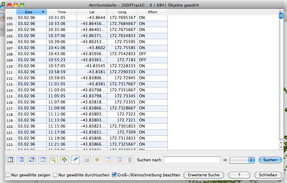
This is how the point layer attribute table looks like: original attribute table
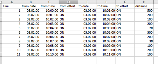
This is how the attribute layer of the line layer should look like: resulting attribute table
I am using QGIS 1.8.0 on a Mac OSX 10.6.8

6
  • Welcome to GIS.StackExchange! Did you try to split the resulting polyline in many line segments? Could you show us what the resulting attribute table should look like?
    – steko
    Commented Mar 2, 2013 at 15:43
  • Hi. I have thought about splitting the resulting polyline, but that does not help, because I need the attributes of the points in the lineshape. I will add picture of what I mean.
    – stefan
    Commented Mar 2, 2013 at 17:16
  • Ok, I cant figure out how to add images here. Basically the attribute table of the line layer should include single lines with every attribute from the individual starting point and from the individual ending point. Plus the distance between those points.
    – stefan
    Commented Mar 2, 2013 at 18:17
  • I need 10 forum points to add images. Since I am new here it does not work... sorry
    – stefan
    Commented Mar 2, 2013 at 18:47
  • Upload something to imgur and link to it - then an admin will probably embed it in the post for you.
    – L_Holcombe
    Commented Mar 2, 2013 at 19:11

1 Answer 1

1

I ended up making a WKT code for lines in excel looking like that: LINESTRING(Long Lat, Long Lat). As starting coordinates I have used the Long and Lat of the same raw and for the ending coordinates the Long and Lat of the next raw. Then imported it as tab delimited text, ticked WKT, and done.

Your Answer

By clicking “Post Your Answer”, you agree to our terms of service and acknowledge you have read our privacy policy.

Not the answer you're looking for? Browse other questions tagged or ask your own question.