6

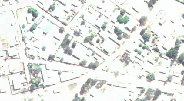
Is it possible to colour match two separate satellite images taken at two different times? I am working with two high resolution, multispectral images that were taken approximately one year apart and I want to do some change analysis with them. Unfortunately one of the images is extremely washed out in urban areas and I'm trying to correct it (see attached samples).

Image From Time 1 Sample Time 1

Image From Time 2 Sample Time 2

Ideally, I would like to have both of the images to appear as similar as possible, preferably like the first one, so I can identify changes between the two time periods. I am using ArcGIS 10.2 Professional, but if there are other options to deal with this I would like to hear about those as well.

3 Answers 3

6

The effects you are seeing are atmospheric effects due to differences in atmospheric aerosols, sun angle, and Rayleigh scattering. Since you have two scenes of the same location, though at different time periods, I would recommend using a technique called Dark Object Subtraction (DOS) (Song et al. 2001). From the ENVI web site:

Dark object subtraction searches each band for the darkest pixel value. Assuming that dark objects reflect no light, any value greater than zero must result from atmospheric scattering. The scattering is removed by subtracting this value from every pixel in the band. This simple technique is effective for haze correction in multispectral data, but it should not be used for hyperspectral data.

DOS is easily performed in ENVI or Erdas Imagine. You can also build a model in ArcGIS to subtract the band minimum from each band. I highly recommend reading the paper I included as this is one of the best, most widely cited papers on when and how to correct for atmospheric effects.

Reference:

Song, C., Woodcock, C. E., Seto, K. C., Lenney, M. P., & Macomber, S. A. (2001). Classification and change detection using Landsat TM data: when and how to correct atmospheric effects?. Remote sensing of Environment, 75(2), 230-244.

2
  • The actually issue was related to the way the imagery was color corrected. I'm marking this answer as correct because it was very useful in helping me sort out the issue and the reference was a good read.
    – dblanchett
    Commented Dec 9, 2014 at 12:09
  • @dblanchett What was your solution then if it was not DOS?
    – Jens
    Commented Apr 16, 2019 at 19:18
0

There is a help file here at the ESRI site http://resources.arcgis.com/en/help/main/10.2/index.html#//009t000000nn000000

In the table of contents on Arcmap go into properties for the second raster file, go to the display tab and reduce the contrast and brightness settings until close to the first raster.

http://resources.arcgis.com/en/help/main/10.1/index.html#/Improving_the_brightness_contrast_or_gamma_of_your_raster_layer/009t00000084000000/

0

I'd suggest to try regression analysis. Convert both images to grids, 3 bands ( ?). Create few hundred random sampling points. Sample corresponding bands and see (Excel) if correlation between 1st and 2nd rasters exist. If you are happy with correlation coefficients, use regression coefficients ( slope and intersect if relation is linear) and rasrer calculator to compute each 'new' band. Make sure results are integers in range 255. Compose bands to see result. I don't think though, you'll get a good correlation. Worth a try...

1
  • Ooops. Color matching from 1st answer does the same thing. Sorry
    – FelixIP
    Commented Aug 10, 2014 at 3:16

Your Answer

By clicking “Post Your Answer”, you agree to our terms of service and acknowledge you have read our privacy policy.

Not the answer you're looking for? Browse other questions tagged or ask your own question.