1

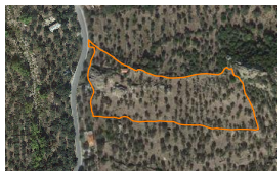
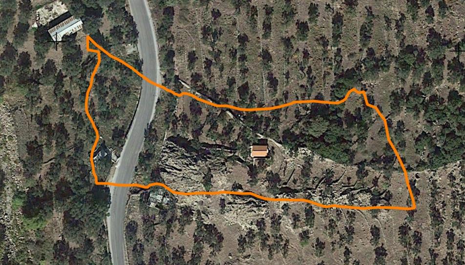
I have a shapefile in CRS 2100. I use the OpenLayers plugin and inserted Google satellite as background. It changes the project's CRS into EPSG::3857(OTF). So, in the composer manager, when I try to save the work as a PDF or image, the result is to change the zoom level of the project. I saved the shapefile into CRS EPSG::3857 and did the same work, but I had the same results.

Is there a way to fix it?

Project in the QGIS What appears in the PDF file

8
  • it seems that the datum transformation parameters were not picked up. What's your project's Projection?
    – nickves
    Commented Apr 22, 2016 at 12:06
  • It is 2100. At the Settings>options>CRS,is selected, Automaticaly enable 'on the fly....... and "always start new projections with 2100 CRS. At the new project with CRS 3857 I had selected, "don't enable on the fly projection", Always start with 3857 as selected CRS" CRS for new Layers is selected "Prompt for CRS"
    – Pitheas
    Commented Apr 22, 2016 at 12:12
  • 1
    Openlayer seems to misbehaving when you stream it. As an alternative I can suggest you either save the image locally with the src properly defined in it, or use a proper WMS server. Ktimatologio WMS should cover you
    – nickves
    Commented Apr 22, 2016 at 12:44
  • Also I can print screen the picture of the map in print composer and put it over the map area and with the rendering tools to fix the position and finish my work. It has scale 1/2500 and I'll print it on an A3 paper, I don't think any graphical error to be visible. I don't understand why in the print composer the CRS transformation is ok but in the exported PDF file it loses it. Do I have to check something? I've tried base map of ktimatologio, but a message appears that I cannot save/print that wms layer+the visible error is lost at a scale over 1/10000
    – Pitheas
    Commented Apr 22, 2016 at 13:08
  • 1
    Regarding your comment 'the visible error is lost at a scale over 1/10000': The lowest width of a line that it's visible to a human eye is about 0.1mm, that for a scale 1:10000 that translates to a misplacement of 1m. Also in a case of a printed map take into consideration the 'half of pixel' rule. I would suggest to check with your specifications before deciding 'the error is lost'.
    – nickves
    Commented Apr 22, 2016 at 13:37

1 Answer 1

1

Be careful with the resolution (ppp) of your composition. the WMS, or another web maps service no OGC, have a limit of resolution, 96 dpi, 120 dpi or similar.

Try to down this parameter.

1

Your Answer

By clicking “Post Your Answer”, you agree to our terms of service and acknowledge you have read our privacy policy.

Not the answer you're looking for? Browse other questions tagged or ask your own question.