2

I have to calculate area from a georeferenced tiff image. I want to find the whole area in the raster. The two methods I tried was : 1.Using the area measurement tool in QGIS toolbar. 2.Vectorized the raster . Extracted the number of pixels. Calculated pixel resolution in QGIS. Multiplied the number of pixels with area of one pixel.

The area measured in the 2 methods gave two different values. Could you tell me any another method other than Calculating area of rasters in QGIS?

1
  • 1
    Some more information would be helpful, e.g. what data do you have, what areas do you want to find, how large is your area of interest, how often do you have to repeat this procedure?
    – Erik
    Commented Mar 26, 2018 at 10:54

2 Answers 2

4

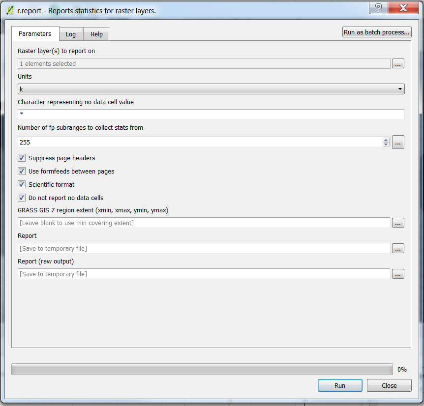
A different approach that you can explore is the command r.report from GRASS in the processing toolbox.

The GRASS man page is here: https://grass.osgeo.org/grass74/manuals/r.report.html

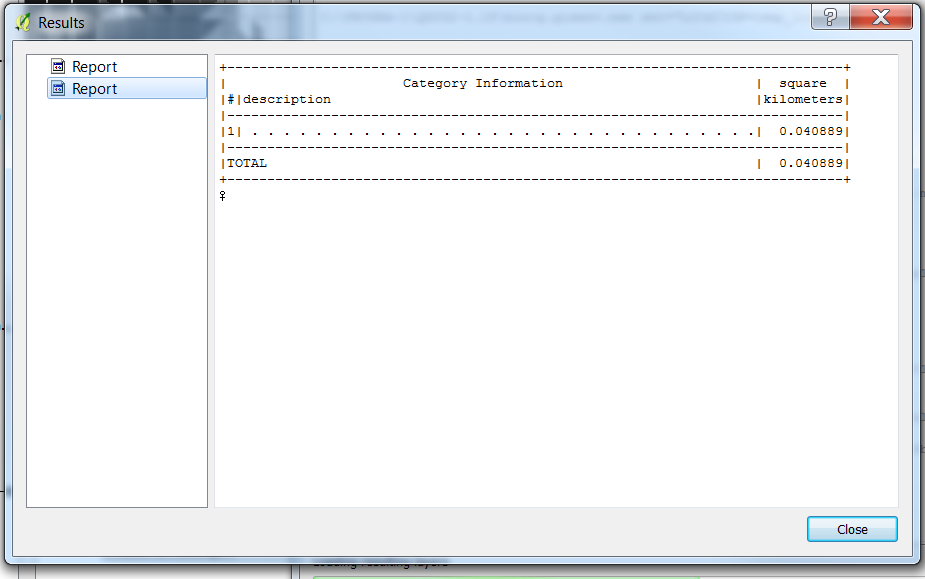
And these are the screenshots from QGIS 2.18.14. In the picture below the raster has only one category value (1) and the result is in km^2 (k).

enter image description here

enter image description here

3
  • HI, This somehow gives me a different value from which I calculated in QGIS(using measurement tool and polygon digitization). Why could that be ?
    – Deepthi
    Commented Apr 5, 2018 at 12:23
  • How different? The raster math in GRASS depends of the resolution of the current geographic region, while a vectorization might be different. You do not say anything about the projection and resolution of your tiff file nor about the input to the r.report command. If the difference is signifiative, it might be worth a new question
    – Marco
    Commented Apr 5, 2018 at 19:28
  • The resolution of the tiff image[which is an orthophoto] that i used for calculation was 5cm. No input info of projection or resolution was given in the command. The area from polygon and r.report has significant variation.
    – Deepthi
    Commented Apr 13, 2018 at 6:25
1

Some more details, especially on your data and the goal of your research, would still be appreciated, in order to be more specific. Anyway, there are two ways to acquire the desired data:

  1. Load the geotiff into QGis, add a vector layer and manually digitize all the areas you need. Then make sure your vector layer is using the correct UTM-CRS for your area, then open the field calculator and add an integer-field with the expression $area. This gives you the area in square-meter. Works for both drawings and remote sensing data.
  2. Classify your image. Though more work-heavy, this should give you a more precise outcome and - if intended - allows you to build a timeline for an area, using the same training areas again and again. Works only with remote sensed data.

Your Answer

By clicking “Post Your Answer”, you agree to our terms of service and acknowledge you have read our privacy policy.

Not the answer you're looking for? Browse other questions tagged or ask your own question.