1

Trying to work with exported data tables from Network Analyst of an origin-destination matrix for further network analysis like centrality measures...etc., but having to re-organize the origin and destination into their separate columns for other software like Python or NodeXL to perform well.

Is taking up quite a bit of time to do manually, does anyone know of any workarounds?

1
  • Welcome to GIS SE! Thank you for having taken the Tour to learn about our focussed Q&A format. The answer for rearranging geodatabase tables is often ArcPy update cursors, but before we can advise on that we will need to see what your input data looks like, what you seek in your output data, and what your code so far looks like.
    – PolyGeo
    Commented May 14, 2018 at 3:49

1 Answer 1

1

I guess you'd like a rectangular matrix. This is one of non-scripting options.

arcpy.MakeXYEventLayer_management("points_PointDistance", "INPUT_FID", "NEAR_FID", ..., in_z_field="DISTANCE")

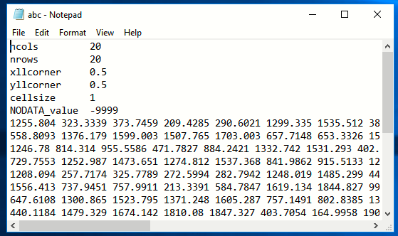
Export events table into shapefile, delete associated prj file and add it to new mxd. Add geometry attributes and convert points to raster using Point_Z and cell size of 1. Replace NO DATA values by 0, using raster calculator and export result to ascii. This is how output text file will look like:

enter image description here

Your Answer

By clicking “Post Your Answer”, you agree to our terms of service and acknowledge you have read our privacy policy.

Not the answer you're looking for? Browse other questions tagged or ask your own question.