5

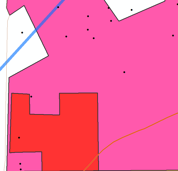
I am mapping an area where there are a lot of overlapping features because of certain Oil & Gas wells being drilled within the same geographic area, but to different depths and maintained by different companies.

There might be one large Oil & Gas unit (polygon) that is drilled to 5,000' and another smaller unit (polygon) within the same geographic boundary that is drilled to 10,000'.

Each polygon is symbolized based on company, so I have been messing with symbol levels to draw certain ones on top, but I don't feel like this is the best way to get ArcMap to automatically draw smaller ones on top and keep the larger ones on bottom. Is this possible?
enter image description here

2 Answers 2

11

ArcMap just orders based on geometry type: 1. Points, 2. Lines, 3. Polygons.

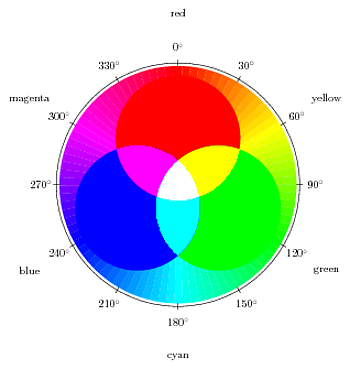
My suggestion is to use transparency to help you symbolize these overlapping features. Take a look at a color wheel when you're selecting colors and choose colors that have good additive properties.

enter image description here

By using this technique you'll be able to identify the individual layers and areas where they overlap. Adjust your transparency accordingly.

If the polygon boundaries overlap EXACTLY, your best bet might be to add a depth value into the attribute table, which you could use ArcScene to visualize your data in 3D.

3
  • +1, Another way to symbolize data that overlaps to a large extent is to make a series of small multiple maps.
    – Andy W
    Commented Jul 19, 2012 at 0:49
  • Another reason to use transparency is that it eliminates ambiguity. Imagine a polygon that overlaps two lower layer ones. Without transparency you can't tell where the two lower polygons meet. In fact, you can't tell if the upper polygon is over the lower ones, or is just another piece in a jigsaw puzzle of polygons.
    – Llaves
    Commented Jul 19, 2012 at 3:17
  • If the areas exactly overlapped, you could also symbolize one as being slightly buffered outside the other, probably best done with a hollow interior color.
    – DPierce
    Commented Feb 19, 2013 at 14:10
4

One way to guarantee the smaller polygons always draw on top is to add two (or more if needed) instances of the same layer to the map. The lower instance in the layer list should be queried to only show the larger polygons, and the higher instance queried to show smaller polygons. From there you can adjust symbology, including transparency, as necessary.

1
  • 1
    I had to mess around with the Legend to get it to show up correctly after making a copy of each layer. ESRI REALLY needs to simplify the process of creating and customizing a Legend in ArcMap. The User Experience is just awful. Thanks for your help guys.
    – denim_dan
    Commented Jul 25, 2012 at 23:40

Your Answer

By clicking “Post Your Answer”, you agree to our terms of service and acknowledge you have read our privacy policy.

Not the answer you're looking for? Browse other questions tagged or ask your own question.