1

I am new to QGIS and am exploring some open data sets from NYC as a self-guided project.

I am trying to map the branches of Brooklyn Public Library with a simple base map file of NYC streets, zip codes etc. The lat and long data for the library data looks like this:

A text sample is as follows:

lat long
40.680456600000 -73.887288700000
40.680456600000 -74.029523500000
40.633650700000 -73.956194800000
40.681817000000 -73.989122700000
40.638920000000 -73.966799500000
40.576178400000 -73.994015000000
40.694073700000 -73.948610700000
40.675355100000 -73.908388200000
40.671344700000 -73.939602100000
40.704528500000 -73.899383100000
40.642131900000 -73.998031000000
40.683229000000 -73.968208400000
40.672480800000 -73.947958200000

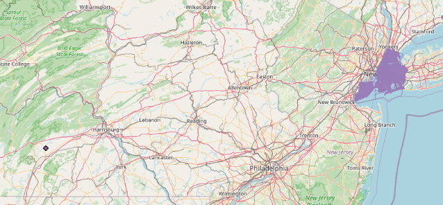
I have tried aligning the projection to the NYC shapefile (which is correct because it lines up with the OpenStreetMap, WGS 84 (CRS84) OGC:CRS84) but the library coordinates keep getting placed in Pennsylvania, and seem to be incredibly close together.

Smushed library points, zoomed in A LOT

Yikes, something is off here

I have tried changing the projections and ended up in locations like Antarctica and Northern Africa... I truly have no idea how to fix this. I am a very new user, and even previously answered questions that were similar to this were a bit confusing to me.

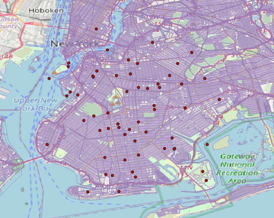
EDIT: Please see below -- after successfully changing the projection to match the other layers and base map (OGC:CRS84 - WGS 84), we are in New York, but still slightly off. Note that there are libraries showing up in the water and in Manhattan, when they should only be in Brooklyn.

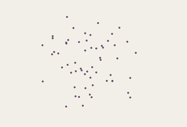
successfully in New York, but still off

4
  • 1
    How are you changing the projection? You need to find out what the projection is for the source data. Then when you import the x,y data, use that projection. Then use the reproject layer tool to reproject the data into WGS84
    – jbalk
    Commented Jan 10, 2022 at 22:40
  • What does "aligning the projection to the NYC shapefile" mean? These coordinates look like latitude and longitude, and that is coordinate system EPSG 4326, aka WGS84, (check your sources for a correct reference) and when I load them into QGIS they are in New York.
    – Spacedman
    Commented Jan 10, 2022 at 22:40
  • Could you paste your CSV coordinates as text? Otherwise we have to type them from your screenshot, which is slow and prone to errors.
    – Spacedman
    Commented Jan 10, 2022 at 22:44
  • Thank you!! EPSG 4326 worked to place them in New York, but it still appears to be a bit off as some of the points are in the water. I was previously used EPSG 2263 which is labeled for NYC and Long Island. Here is the text of some of the CSV coordinates lat long 40.680456600000 -73.887288700000 40.680456600000 -74.029523500000 40.633650700000 -73.956194800000 40.681817000000 -73.989122700000 40.638920000000 -73.966799500000 40.576178400000 -73.994015000000 40.694073700000 -73.948610700000 40.675355100000 -73.908388200000 40.671344700000 -73.939602100000
    – lisa
    Commented Jan 10, 2022 at 22:46

1 Answer 1

2

After a painfully embarrassing discovery I am realizing problem number 2 (libraries showing up in the water) is with the base data, not QGIS. Knowing which projection to set was incredibly helpful!

Your Answer

By clicking “Post Your Answer”, you agree to our terms of service and acknowledge you have read our privacy policy.

Not the answer you're looking for? Browse other questions tagged or ask your own question.