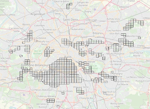
I am trying to consume city of Paris WMTS source with EPSG:2154 and convert that to iD compatible (OpenStreetMap compatible) tile server (WMS or TMS).
The map is visible here et here is an example of tile.
I cannot get it working. I have already followed this guide https://lists.osgeo.org/pipermail/mapproxy/2013-August/001674.html
Can someone check this out and say what I am doing wrong.
The WMTS GetCapacibilities is available here.
mapproxy.yaml:
services:
  tms:
  wmts:
  wms:
  demo:

layers:
  - name: planches_igc2
    title: Plan de l'Inspection Générale des Carrières de la ville de Paris
    sources: [planches_igc2]


caches:
  planches_igc2:
    grids: [utm32n]
    sources: [planches_igc_wmts]


sources:
  planches_igc_wmts:
    type: tile
    url: https://capgeo2.paris.fr/public/rest/services/IGC/IGC_Atlas_carrieres_image/MapServer/WMTS/tile/1.0.0/IGC_IGC_Atlas_carrieres_image/default/default028mm/%(z)s/%(x)s/%(y)s.png
    grid: utm32n

grids:
    webmercator:
        base: GLOBAL_WEBMERCATOR
    utm32n:
      origin: 'nw'
      srs: 'EPSG:2154'
      bbox_srs: 'EPSG:2154'
      tile_size: [256,256]
      bbox: "637827.9419,6849420.6548000015,670590.5560000017, 6874797.487399999"
      res: [
           #  res            level     scale @90.7 DPI
            305.7480111760, #  0     1091957.18277137
            152.8740055880, #  1      545978.59138569
             76.4370027940, #  2      272989.29569284
             38.2185013970, #  3      136494.64784642
             19.1092506985, #  4       68247.32392321
              9.5546253492, #  5       34123.66196161
              4.7773126746, #  6       17061.83098080
              2.3886563373, #  7        8530.91549040
              1.1943281687, #  8        4265.45774520
              0.5971640843, #  9        2132.72887260
              0.2985820422, # 10        1066.36443630
              0.1492910211, # 11         533.18221815
              0.0746455105, # 12         266.59110908
      ]


globals:

