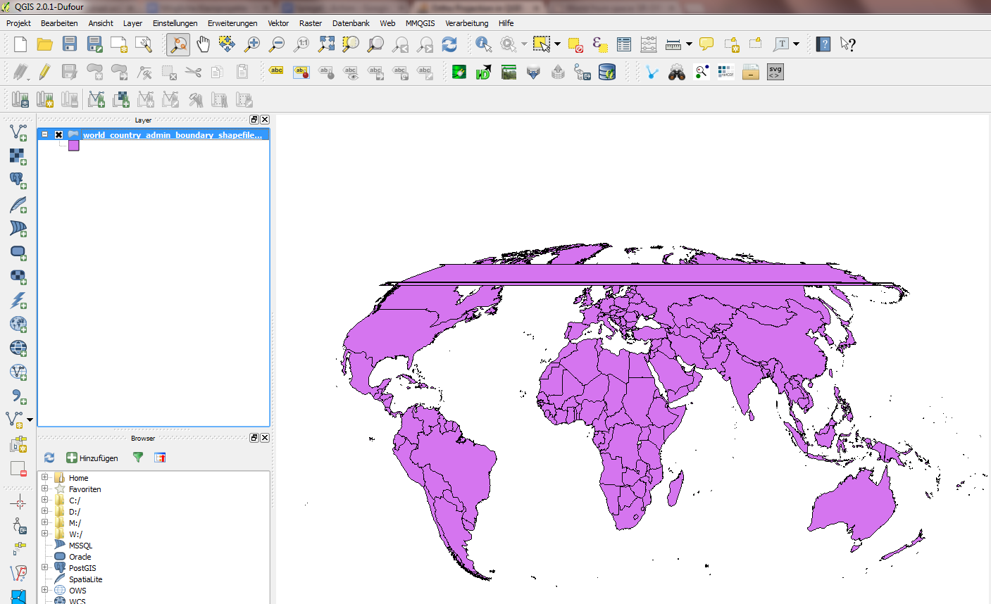
As Andre said, for this to work, you'll need to crop your layer before projecting it. Andre describes a manual method, which works well for a lot of cases: Project your shapefile to an azimuthal equidistant projection with the same parameters as the orthographic projection, create a clipping circle that covers the hemisphere that will be visible in the orthographic projection, and clip the shapefile with that. However, that method requires a fair bit of manual effort, and doesn't work for all projection parameters, since projecting to an azimuthal equidistant projection can lead to similar problems as projecting to an orthographic projection.
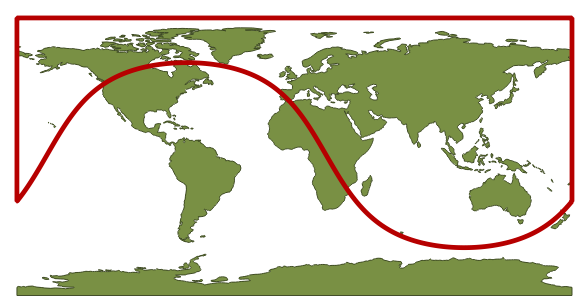
Here's a script (now also available as the Clip to Hemisphere QGIS plugin) that takes a slightly different approach: A clipping layer is created in the coordinate reference system of the original shapefile by projecting a circle from the orthographic to the source CRS, but additionally making sure to cover the whole visible hemisphere, including the visible pole.
This is what the clipping layer looks like for an orthographic projection centered on 30°N, 110°E:

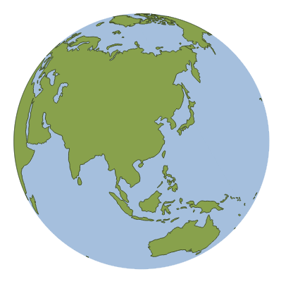
The script then clips the currently selected layer with the clipping layer, and adds the resulting layer to the project. That layer can then be projected to the orthographic projection, either on the fly or by saving it in the orthographic CRS:

Here's the script. Make sure to save it in your Python path, for example as 'cliportho.py'. Then you can import it in the QGIS Python console using import cliportho. To clip a layer, call cliportho.doClip(iface, lat=30, lon=110, filename='A.shp').
import numpy as np
from qgis.core import *
import qgis.utils

import sys, os, imp


def doClip(iface, lat=30, lon=110, filename='result.shp'):
    sourceLayer = iface.activeLayer()

    sourceCrs = sourceLayer.dataProvider().crs()

    targetProjString = "+proj=ortho +lat_0=" + str(lat) + " +lon_0=" + str(lon) + "+x_0=0 +y_0=0 +a=6370997 +b=6370997 +units=m +no_defs"
    targetCrs = QgsCoordinateReferenceSystem()
    targetCrs.createFromProj4(targetProjString)

    transformTargetToSrc = QgsCoordinateTransform(targetCrs, sourceCrs).transform

    def circlePolygon(nPoints=20, radius=6370000, center=[0,0]):
        clipdisc = QgsVectorLayer("Polygon?crs=epsg:4326", "Clip disc", "memory")
        angles = np.linspace(0, 2*np.pi, nPoints, endpoint=False)
        circlePoints = np.array([ transformTargetToSrc(QgsPoint(center[0]+np.cos(angle)*radius, center[1]+np.sin(angle)*radius)) for angle in angles ])
        sortIdx = np.argsort(circlePoints[:,0])
        circlePoints = circlePoints[sortIdx,:]
        circlePoints = [ QgsPoint(point[0], point[1]) for point in circlePoints ]
        circlePoints.extend([QgsPoint(180,circlePoints[-1][1]), QgsPoint(180,np.sign(lat)*90), QgsPoint(-180,np.sign(lat)*90), QgsPoint(-180,circlePoints[0][1])])
        circle = QgsFeature()
        circle.setGeometry(QgsGeometry.fromPolygon( [circlePoints] ) )
        clipdisc.dataProvider().addFeatures([circle])
        QgsMapLayerRegistry.instance().addMapLayer(clipdisc)
        return clipdisc

    auxDisc = circlePolygon(nPoints = 3600)

    ###### The clipping stuff
    ## Code taken from the fTools plugin

    vproviderA = sourceLayer.dataProvider()
    vproviderB = auxDisc.dataProvider()

    inFeatA = QgsFeature()
    inFeatB = QgsFeature()
    outFeat = QgsFeature()

    fitA = vproviderA.getFeatures()

    nElement = 0
    writer = QgsVectorFileWriter( filename, 'UTF8', vproviderA.fields(),
                                  vproviderA.geometryType(), vproviderA.crs() )

    index = QgsSpatialIndex()
    feat = QgsFeature()
    index = QgsSpatialIndex()
    fit = vproviderB.getFeatures()
    while fit.nextFeature( feat ):
        index.insertFeature( feat )

    while fitA.nextFeature( inFeatA ):
      nElement += 1
      geom = QgsGeometry( inFeatA.geometry() )
      atMap = inFeatA.attributes()
      intersects = index.intersects( geom.boundingBox() )
      first = True
      found = False
      if len( intersects ) > 0:
        for id in intersects:
          vproviderB.getFeatures( QgsFeatureRequest().setFilterFid( int( id ) ) ).nextFeature( inFeatB )
          tmpGeom = QgsGeometry( inFeatB.geometry() )
          if tmpGeom.intersects( geom ):
            found = True
            if first:
              outFeat.setGeometry( QgsGeometry( tmpGeom ) )
              first = False
            else:
              try:
                cur_geom = QgsGeometry( outFeat.geometry() )
                new_geom = QgsGeometry( cur_geom.combine( tmpGeom ) )
                outFeat.setGeometry( QgsGeometry( new_geom ) )
              except:
                GEOS_EXCEPT = False
                break
        if found:
          try:
            cur_geom = QgsGeometry( outFeat.geometry() )
            new_geom = QgsGeometry( geom.intersection( cur_geom ) )
            if new_geom.wkbType() == 0:
              int_com = QgsGeometry( geom.combine( cur_geom ) )
              int_sym = QgsGeometry( geom.symDifference( cur_geom ) )
              new_geom = QgsGeometry( int_com.difference( int_sym ) )
            try:
              outFeat.setGeometry( new_geom )
              outFeat.setAttributes( atMap )
              writer.addFeature( outFeat )
            except:
              FEAT_EXCEPT = False
              continue
          except:
            GEOS_EXCEPT = False
            continue
    del writer

    resultLayer = QgsVectorLayer(filename, sourceLayer.name() + " - Ortho: Lat " + str(lat) + ", Lon " + str(lon), "ogr")
    QgsMapLayerRegistry.instance().addMapLayer(resultLayer)


