1

I have added a layer with tracks and track points from OSM in QQGIS and exported this GPX file into an shapefile. Now I wanted to calculated the area of the buildings. I tried to do this with the tracks which also distribute the outlines of the different buidlings. But the function $area did not work in the attribute table. So how can I get the GPX file or shape file with tracks and trackpoints into a layer with polygons?

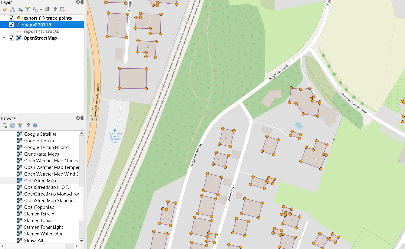
enter image description here

This a picture of the track and trackpoint layer. I need the areas of all buildings to do a furter calculations.

2
  • 2
    How many buildings are shown by this data? It would help if you could edit your question and share a picture of your track and track point layer.
    – Simbamangu
    Commented Jul 22, 2019 at 13:02
  • 1
    What about caring about your previously asked question ?
    – Snaileater
    Commented Jul 22, 2019 at 13:48

1 Answer 1

3

You cannot measure the area of a lines layer.

Convert your lines layer (building outlines) into polygons.

Try Vector>Geometry Tools>Lines to Polygons then reapply your $area expression on the output. The output might require some tweaking if the line nodes to not join together. If you have gaps in the output, try buffering it by 1m and dissolve the result, then apply a buffer of -1m.

Your Answer

By clicking “Post Your Answer”, you agree to our terms of service and acknowledge you have read our privacy policy.

Not the answer you're looking for? Browse other questions tagged or ask your own question.