I currently looking forward to process LiDAR point clouds (forest data) using Quick Terrain Modeler (QTM), but is it possible to create Canopy Height Model directly using the software?
1 Answer
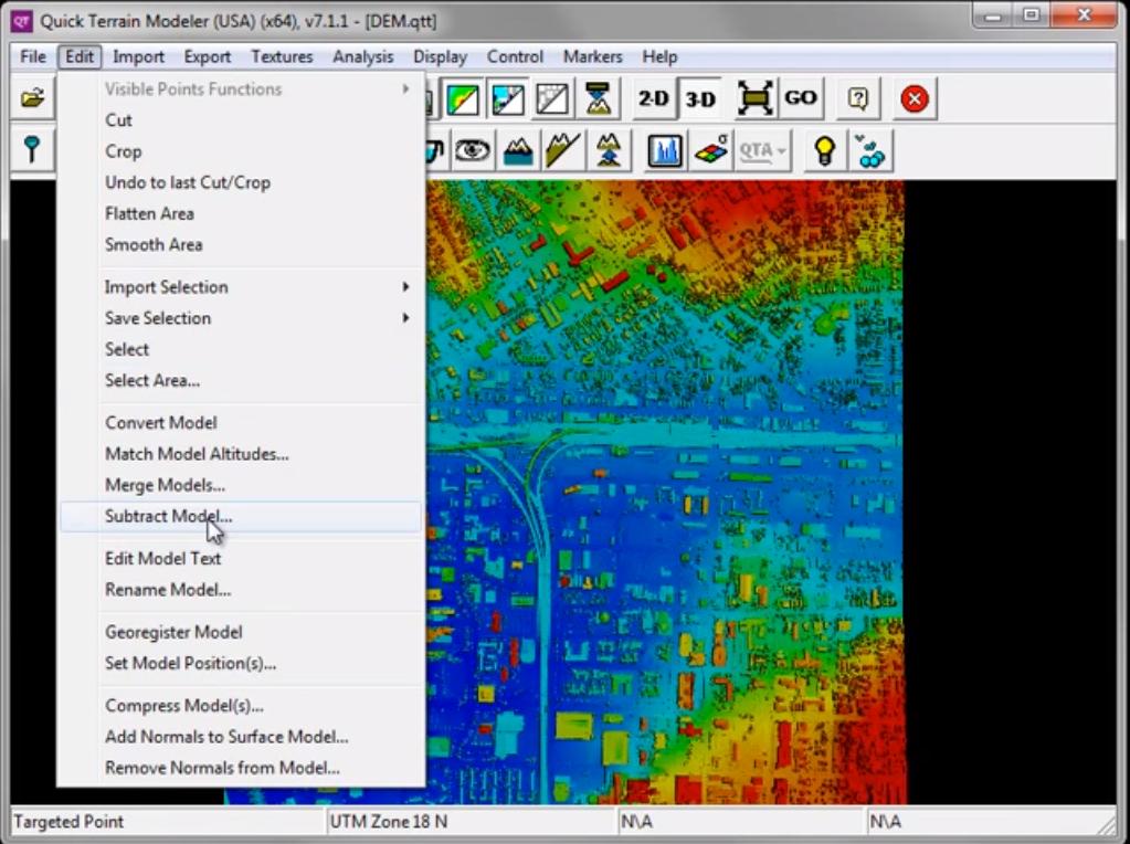
To obtain a Canopy Height Model (CHM), subtract the DEM from a DSM using the Subtract Model tool:
Take a look at Quick Terrain Modeler: Importing LAS to DEM/DSM tutorial. The part you are interested begins in 4:58, but I advise watching the full video (the above picture was taken from it).
I also find the Quick Terrain Modeler: Above Ground Analysis tutorial useful, because it teaches to build a Digital Elevation Models from both unclassified and classified point clouds, and then, to normalize points using the created DEM. The 'DSM' resulting from a normalized point cloud is the CHM.
In case one is confused about the DEM or DSM terminology, I suggest reading What is the difference between DEM, DSM and DTM?
About if "QTM can be an autonomous processing software for biomass estimation of the forest":
Usually, when working with LiDAR data aiming to estimate forest biomass (both through an area-based approach or a single-tree approach) there will be more than one software involved. Hence, QTM won't work for performing all necessary steps (for example, tree segmentation). For the latter, take a look at:
Extracting tree crown areas from remote sensing data (visual images and LiDAR)
What I usually do when modelling forest biomass is to use a statistic software such as R, and call other tools for processing LiDAR data from there. For example, see Retrieving LiDAR metrics from relative vertical layers of point cloud.
-
-
as far as i know, the software is limited to certain extend only and for further analysis, we have to proceed to other GIS software; ArcGIS for example Commented Dec 7, 2017 at 3:27
-
@FarhanRajuli, I complimented my answer to explain what I do in terms of software used when modelling forest biomass with LiDAR data. Best. Commented Jan 2, 2018 at 21:08

