Short answer: there is project CRS and layer CRS:
- You can more or less freely choose any project CRS, QGIS handles the rest automatically.
- You can't "set" another CRS for your layer (your data), it will show your data completely offset in another part of the globe. If that happens, set the layer's CRS back to the initial CRS the layer was created in.
Project CRS
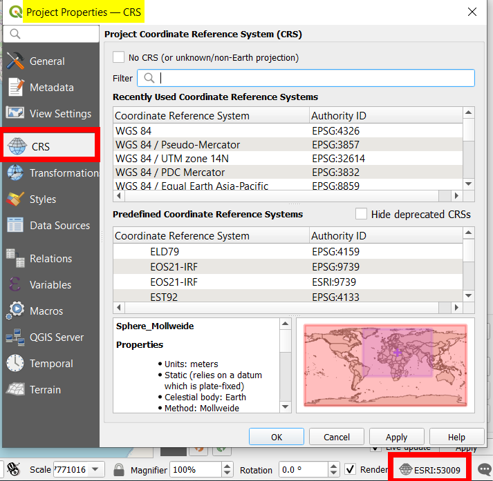
The project CRS is what QGIS projects your data to: the map canvas. You're basically free to choose any CRS that fits the area you are working on. Only change the project CRS in Menu Project > Properties > CRS tab (or directly open this dialog window form the small icon at the bottom right corner of your QGIS window):
Screenshot: change project CRS

Layer CRS
The layer CRS is the coordinate values your data is in: you can't choose that freely, because your data will be interpreted wrongly. See here for more details: https://gis.stackexchange.com/a/383437/88814
If you have set a project CRS and load data defined in another CRS, QGIS automatically transforms (reprojects) them "on the fly" (in the background, without explicit intervention) so that it fits the project CRS - at least for visualization on the map canvas. If you manually intervene by "changing" the layer CRS, QGIS is not able to correctly transform the coordinates any more.
In the background, the data are still in their original CRS. That can cause issues when using it for processing or measuring. In this case, you should consider re-projecting your data. For the visualization, most times you will not notice a difference - but see this case where there is also a visual difference.

